Been a little busy in the last few days at work and so weather has been neglected....but there has been a highlight - Xmas day was a record breaker this year.
Firstly it was the first ICE day for Xmas day and my 6th for December.
Then it was my lowest mean for Xmas day, see table below
Year Mean Low high
2005 3.0 -2.3 7.1
2006 6.0 5.3 6.7
2008 6.2 4.7 7.1
2009 2.8 1.8 5.4
2010 -1.6 -2.7 -0.4
Then one more record, my first Xmas day without a Beer... was in Bed most of the day with a cold!!
Oh and this post has been written on my new imac!!
Sunday, 26 December 2010
Monday, 13 December 2010

Sunday, 12 December 2010
Weekly update
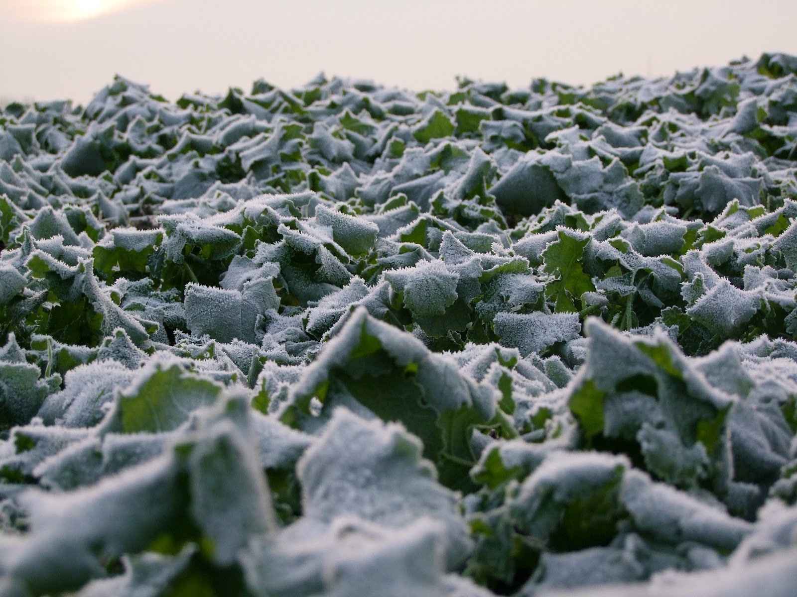
Another cold week, with a couple of mild days - Friday and Saturday. Actually yesterday was the warmest 11th December we have had since 2005. It's turned cold again today with temps below zero and quite a hard frost this morning. You can see the above average 11th in the graph below.

Next week is going to be very interesting, will it snow or won't it? I think it's a given for North England and Scotland.
There is some snow on the charts from Tuesday (Blue stars on the map below) and the Met office is forecasting kent and London to have snow by Thursday evening, How much and for how long is going to be hard to work out
 One thing for sure though, it will be cold all the way through until Xmas day and we should set some cold temperature records.
This year the mean Temp for Dec is 0.3 degrees, the average of the last 6 years is 4.7. This is a significant drop. So far for 2010 the Mean Temp is 1.2 degrees lower than the average of the last 5.1 years. This is significant, they say bad winters come in threes, is this the case or is this a start of the UK cooling down. I know the mean temps for the world is still increasing but there will be variations and ours could mean we get colder, especially with the Gulf stream stagnant, the sun activity at it's lowest and volcanic eruptions.
We'll see how the next 2.5 months pan out before we start beleiving the Mayans!!

Next week is going to be very interesting, will it snow or won't it? I think it's a given for North England and Scotland.
There is some snow on the charts from Tuesday (Blue stars on the map below) and the Met office is forecasting kent and London to have snow by Thursday evening, How much and for how long is going to be hard to work out

This year the mean Temp for Dec is 0.3 degrees, the average of the last 6 years is 4.7. This is a significant drop. So far for 2010 the Mean Temp is 1.2 degrees lower than the average of the last 5.1 years. This is significant, they say bad winters come in threes, is this the case or is this a start of the UK cooling down. I know the mean temps for the world is still increasing but there will be variations and ours could mean we get colder, especially with the Gulf stream stagnant, the sun activity at it's lowest and volcanic eruptions.
We'll see how the next 2.5 months pan out before we start beleiving the Mayans!!
Saturday, 4 December 2010
Colder than Average!
Some more stats on the cold weather.
Since the 14th November it's be colder than the average 5 years!!
Since the 14th November it's be colder than the average 5 years!!
 |
| This Years Temps vrs Last Year |
 |
| This year vrs the average of the last 5 years |
 |
| Min Max Temps |
Thursday, 2 December 2010
Snow clearing!!!
I cleared Pinkys car about 30 mins ago and it's starting to get covered again already


- Posted using BlogPress from my iPhone


- Posted using BlogPress from my iPhone
Another 3 inches over night
Now at 9 inches and snowing like crazy!!!

- Posted using BlogPress from my iPhone

- Posted using BlogPress from my iPhone
Wednesday, 1 December 2010
November stats
TEMPERATURE:
November turned out really cold, with my mean average at 6.3 compared to an average of the last 5 years of 8.14....so nearly 2 degrees lower than average. This is even more amzing when the beginning of the month was so warm. On the 4th November we had a high of 18.1 degrees and a mean 15.7, 18.1 is the highest temperature recorded in November - A RECORD HIGH TEMP FOR NOVEMBER
I also recorded my first ice day since I started to record weather data in 2005. These meant the temperature did not go above zero all day! - RECORD MONTH NUMBER 2!!

RAIN:
Rain was low as well with on 38mm of rain compared to an average of 72mm for November. 2005 was a cold november and there was on 22mm of rain, so there may be a pattern here?
WIND:
Finally November was the month of high winds, I had a 44 mph gust on 11th November 2010 with an average windspeed of 9.5. I have only seen winds greater than this twice since 2005. This was on the 18th Jan 2005 where there was a 45 MPH gust and average winds of 10.2 MPH. The other was the 27th March 2006 where there was a 45 MPH gust and an average of 16.2.
So nearly a record but not quite... now what will December bring?
DECEMBER FORECAST:
My only prediction is it's going to stay cold all month but will it be a record breaking month?
My average mean temperature for December over the last 5 years is 5.2 degrees with last year at 4 degrees so I think it will around the 4 to 5 degree mark. I cannot see how it can fall below 4 degrees but we'll wait and see. The models are changing all the time but I think it will stay cold.
Still snowing!!!
This car was clear last night!!

Starting to drift in the 20mph gusts!!

Baby icicles

Posted using BlogPress from my iPhone

Starting to drift in the 20mph gusts!!

Baby icicles

Posted using BlogPress from my iPhone
Tuesday, 30 November 2010
An unbelieveable day
Today is unbelievable, whilst I am on holiday and can enjoy myself people that have had to work have struggled. My brother is currently stuck in Orpington some 4 miles from his home. He has not moved for 7 hours now and the chances of him getting home tonight must be zero.
At work we have 80% of the work still to get out and I can see us not catching up until Friday.
This snow event is the worse for years, it's still snowing now and so it's not really stopped for 24 hours. It's currently 0.3 degrees with 10 MPH easterly winds.
Great to see a big snow event but as a country we should be more prepared!


Snow
The build up was huge and now it's here, I just wish it was here to stay. We have had 4 inches here now and it's still snowing. Forecast says the snow will turn to rain later so we'll have to see. By Monday the weather will be a lot warmer and should be around the average for the year.
Here are some photos from this morning.


 Whilst I have been doing this it's ben snowing really hard outside!
Here are some photos from this morning.


Monday, 29 November 2010

Sunday, 28 November 2010
Norwich, Lowerstoft - Looking for snow
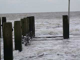
We travelled to Norwich and Lowerstoft today due to wife's job but had an opportunity to see some snow for the first time this winter and it did snow for about 15 minutes whilst we were there. There is something about snow on beaches
Anyway here are the photos:


Anyway here are the photos:


Saturday, 27 November 2010
Record Ice Day
What a record breaking day today has turned out to be. I've been capturing weather data since October 2005 and I have never had a day when the max temperature has been sub zero!!
Today the low was -2.6 at 04:15 and the high was -0.3 at 14:30.
I know Hawley had a -5.5 degrees overnight which is nearly a record breaker but not quite a record!!! the record is -5.9 recorded on the 18th Novembr 2005.
so Whoosh Kennyboy, although -5.5 is a good reading for November

Today the low was -2.6 at 04:15 and the high was -0.3 at 14:30.
I know Hawley had a -5.5 degrees overnight which is nearly a record breaker but not quite a record!!! the record is -5.9 recorded on the 18th Novembr 2005.
so Whoosh Kennyboy, although -5.5 is a good reading for November


Weather station Move!
Re- located the weather station.... I bet it does nothing to temps but it's about peace of mind!


Friday, 26 November 2010
Temperatures today!
How the temperatures changed today - I wasn't expecting a sub zero mean temp.
Cliffe beat Hawley for once! MY mean Temp should end up around -0.1 and Hawley 0.4!
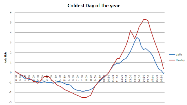
Cliffe beat Hawley for once! MY mean Temp should end up around -0.1 and Hawley 0.4!

Subscribe to:
Posts (Atom)